Starkenberger Panorama path - Etappe: Ehrwald - Fernpass
Long-Distance Hiking (from 5 stages)
Starkenberger Panorama path - 1st stage, from train station Ehrwald to Fernpass
Easy
13,80 km
499 m
04:30 h
Easy
Route
13,80 km
499 m
260 m
04:30 h
1261 m
Starting Point
Bahnhof Ehrwald
End Point
Fernpass
Description
This stage of the Starkenberg Panorama Trail starts at Ehrwald railroad station.
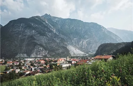
The trail leads along the Loisach through the moss to the end of Ehrwald and on through the larch forest to Biberwier. Passing the Rochus Chapel, you reach the Via Claudia Augusta. At the end of Biberwier, you cross the road and come to the idyllic Loisach springs. Pass the Mittersee and Blindsee lakes on the way up to the Fernpass, the highest point of the Starkenberg Panorama Trail
The trail leads along the Loisach through the moss to the end of Ehrwald and on through the larch forest to Biberwier. Passing the Rochus Chapel, you reach the Via Claudia Augusta. At the end of Biberwier, you cross the road and come to the idyllic Loisach springs. Pass the Mittersee and Blindsee lakes on the way up to the Fernpass, the highest point of the Starkenberg Panorama Trail
Best Season
Jan
Feb
Mar
Apr
May
Jun
Jul
Aug
Sep
Oct
Nov
Dec
Elevation Profile & Characteristics
Skill Level
Endurance
Amenities
Appropriate clothing, sturdy shoes, rain protection and possibly poles. Take plenty of water with you! Climbing equipment not required
Path Conditions
Asphalt and gravel path and trail sections
Public Transport
Parking
You can reach Ehrwald easily by car or public transport
Right at the stage start in Ehrwald, you find a parking lot
Right at the stage start in Ehrwald, you find a parking lot
Impressions