Gondawald-trail Tobadill
Hiking & mountain tour
Leisure and Recreational Hiking
From Tobadill the path leads you down to Burgfried and through the Gondawald back up to Tobadill.
Medium
5,00 km
179 m
01:45 h
Medium
Route
5,00 km
179 m
178 m
01:45 h
1149 m
Starting Point
Tobadill parish church
End Point
Tobadill parish church
Description
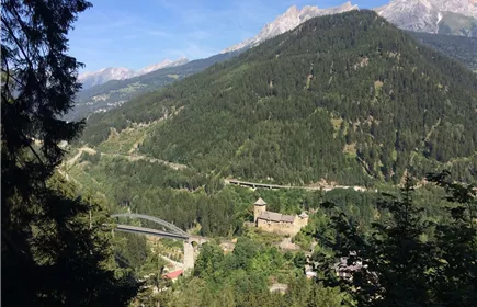
Starting at the church in Tobadill you head west towards Schloss Wiesberg. After about 1.7 km below Burgfried you turn right and follow the signage “Pians“ for about 700 m. At the fork towards the train station Pians keep right and follow the signs towards Gondawald for about 1 km until you get to the paved road. Walk up the road for about 1.5 km until you get back to your starting point at the church.
Best Season
Jan
Feb
Mar
Apr
May
Jun
Jul
Aug
Sep
Oct
Nov
Dec
Elevation Profile & Characteristics
Skill Level
Endurance
Amenities & Features
Family hike
Circular hike
Path Conditions
Asphalt, steep path
Public Transport
From the Landeck-Zams train station, take Line 4 to Tobadill (Kirche stop). Please check the SCHEDULE.